
NavVis Brings Walkable Gaussian Splats to Its Laser-Scanning Platform
IVION 12 lets MLX customers explore beta splat views in a browser, then measure the same scene against the underlying point cloud.
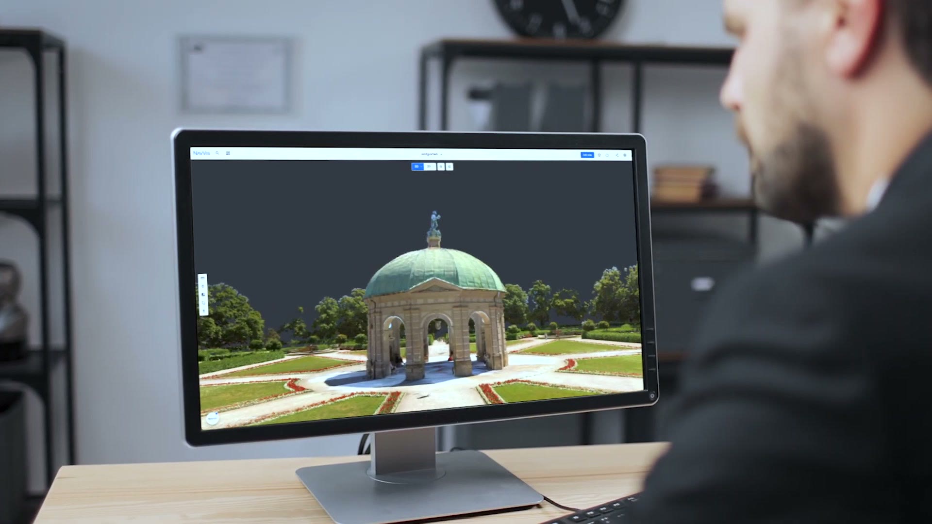
NavVis has added Gaussian splats to IVION 12, giving teams a more lifelike way to move through laser-scanned buildings and outdoor sites in a web browser.
The new Splats view is available as a beta for NavVis MLX customers. It sits beside IVION's point clouds and panoramas, so a project can keep its precise survey data while becoming easier for clients, facility teams, and planners to explore.
Watch the official demo4 min
NavVis IVION Fall 2026 Update
Watch on YouTubeHow the Splat View Works
A panorama places the viewer at the fixed spot where a camera recorded the scene. A Gaussian splat rebuilds the view from millions of soft, colored 3D shapes, letting the viewer move between those positions and look from new angles.
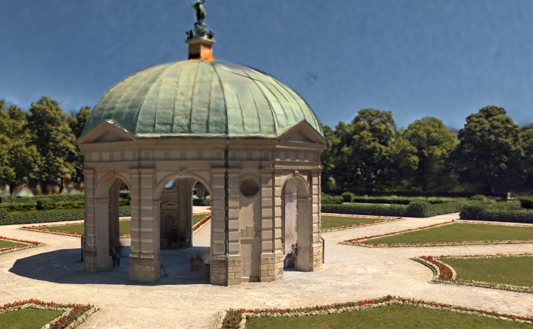
The rendering method was introduced by graphics researchers in 2023. In IVION, users can move continuously through the scene, add points of interest, share a specific viewpoint, and use Mark & Measure. Measurements still come from the underlying point cloud rather than the softer visual surface.
Splats and Point Clouds
A point cloud gives surveyors discrete 3D points they can inspect and measure, but it can be difficult for other people to read. The splat view turns the MLX scanner's geometry and imagery into recognizable color, surfaces, and depth without replacing the technical record.
Availability
IVION 12's redesigned workflow is generally available, but Splats remain a separate beta that NavVis MLX customers must request. NavVis has not said when access will expand or whether VLX captures will be supported.
It is still early, but it is exciting to see NavVis make laser-scanned sites easier for more people to explore without giving up the survey data underneath.
More from Capture & Create.
Browse all stories
Tripo AI · 4 min read
Tripo Adds 3D Animation From Text Prompts
Creators can generate short actions from prompts and combine up to five motion segments, with skeleton options for Unreal Engine, Unity, and avatar workflows.
3D mapping · 2 min read
MultiSet Adds 3D Scan Exports for NVIDIA’s Robot Simulator
The latest update also lets devices find nearby maps automatically, combines separate survey scans, and makes mapped spaces shareable in a browser.

AI tools · 2 min read
OpenAI Teases 20+ Launches at DevDay Today
An always-on AI agent and new model access are reportedly on the way, with Sam Altman’s keynote streaming free at 10 a.m. Pacific.